We’re exploring the people who lived along the lower Saco River in this course and how they adapted to the world changing around them. Their lives centered on the river. They altered it to suit and were subjected to the changes that others made. Upriver dams altered the flow, dropping the water level as much as 8-inches. Underwater jetties were installed to smooth its course.
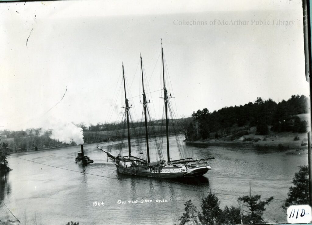
Throughout the nineteenth century, tall ships moved up and down the Saco as far as the falls. They were built and repaired in the Biddeford shipyards. Loaded and unloaded near the mills.
The arrival of tourists introduced a new dimension to the relationship. The river was no longer simply a transport route or a source of food for extraction, it was a site/sight, something to gaze at. Something to consume.
We’re keen to delve deeper into these relationships and stories, but today the plan was to get a better sense of the land and riverscape. There have been some significant changes with time, but we still wanted to see what we could of the place that the Norwoods, the Tarboxes, the Mitchells, the Jordans, and the Goldthwaites, among other families, knew so intimately. Could we find a trace of that Saco River?
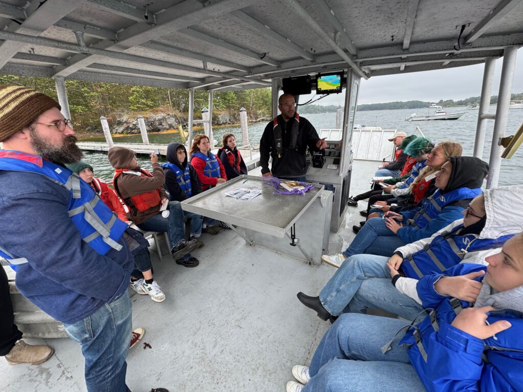
The weather forecast did not call for sustained rain, but when we met our captain, Chris Gregoricus, a man whose resume includes piloting oil tankers up the Mississippi as well as exploring this river from an early age, the sky was grey and the air cool. We crossed our fingers that the rain would hold off.
Once aboard, we headed into the channel only to have a swift gust of wind capture the carefully laminated early map and postcards I’d brought along for comparison. Two landed in the river, necessitating an urgent rescue mission. Things were getting off to a grand start.
Chris spun the boat around and approached the first card. He slowed the motor. At the same time, the students and I dangled Prof. Arthur Anderson off the side of the boat. It may not have been glamorous, but it did the trick. Arthur quickly saved our early map.
_BHL41617299.jpg)
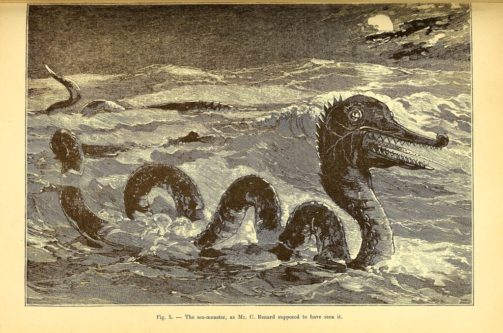
A second pass brought us to the second card. Again, we hung Arthur over the side. He reached out … only to have the card disappear under the waves just as his fingers made contact. I can only assume that it was Cassie, a sea monster first spotted in the area in 1779 by Edward Preble, who wrentched it from his grasp. The poor thing must be starved for information. We were lucky that it didn’t snatch Arthur.
Rescue completed, we ventured across the channel to identify the location of a fishing pier that once extended far into the river from Camp Ellis. In its day, the pier was often photographed and was the subject of numerous postcards.
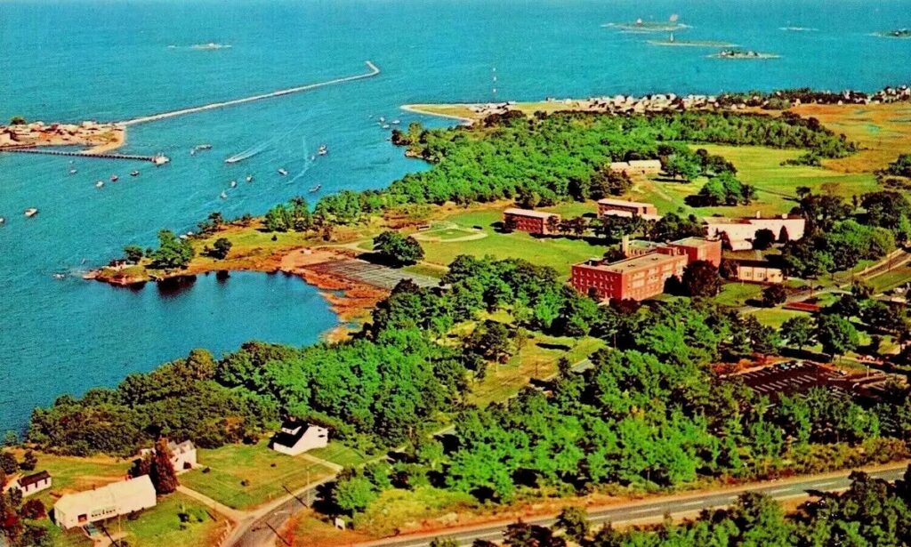
The little community has changed dramatically, largely due to the construction of a massive jetty that extends into Saco Bay, disrupting the usual wave patterns and the distribution of sand. While the jetty did do away with a sand bar that once marked the opening of the river, it resulted in dramatic erosion at Camp Ellis which now loses a street every decade to the sea.
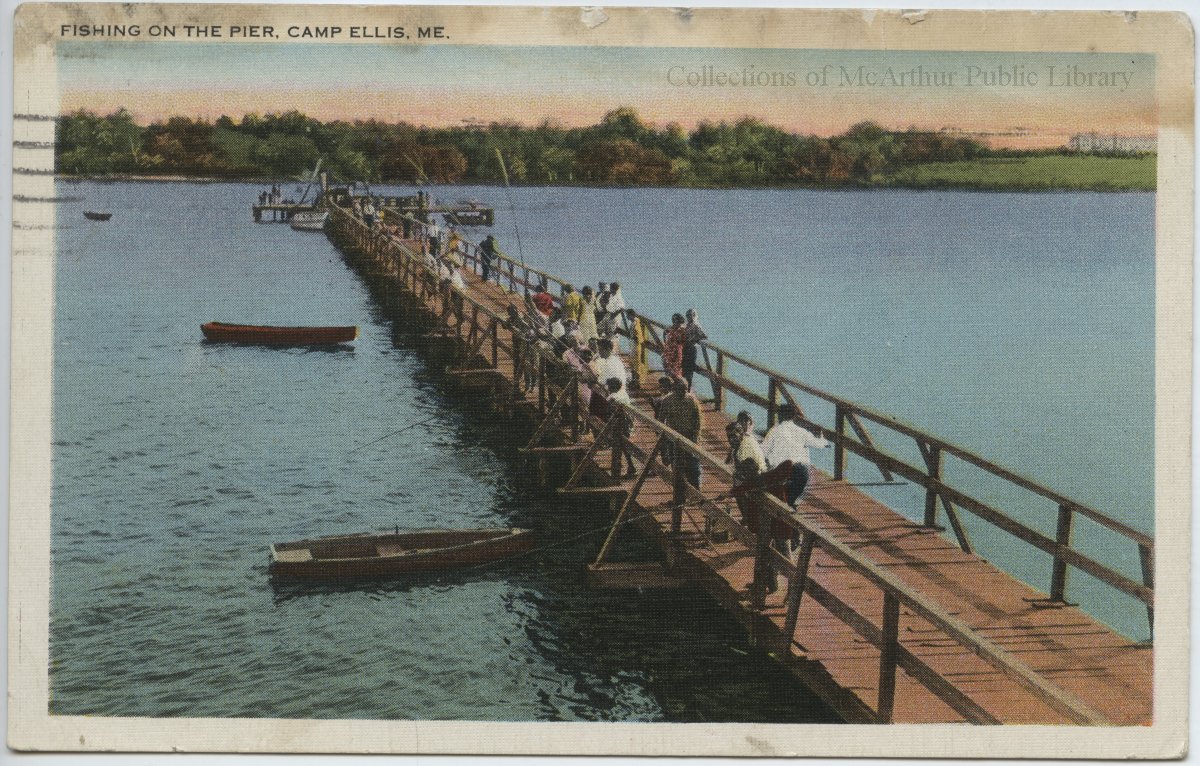
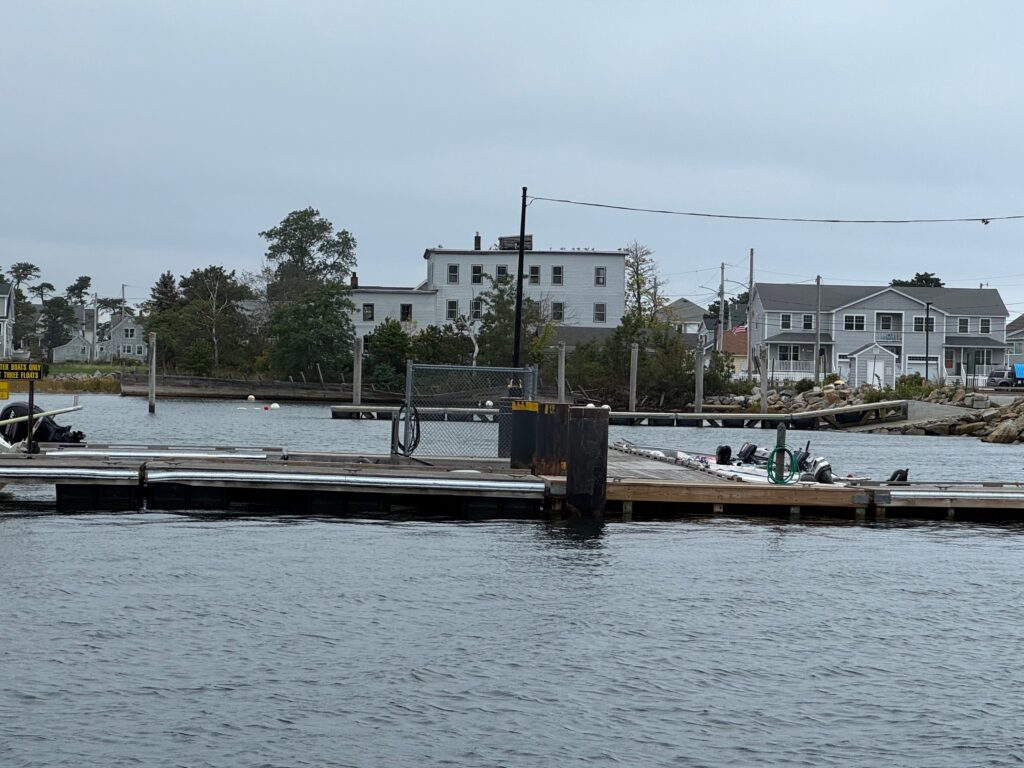
We soon spotted a building that is obvious in the old postcards. The pier jutted out from its eastern edge. We’d found our spot.
Next, we sailed up the river to the mouth of “The Narrows.” It’s a scenic locale that soon captures the sightseer’s gaze, even now.
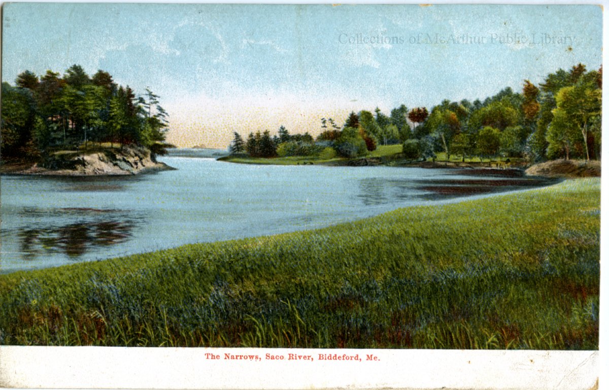
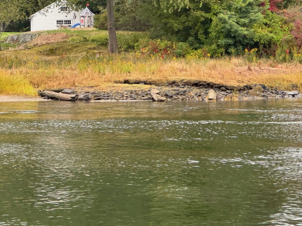
We were keen to see two things. First, we wanted to get a sense of how much the landscape has changed. There are now several houses that weren’t there in 1910, but the more interesting alteration looks to have involved filling in some marsh to make way for two houses.
The second thing we were looking for was evidence of a ferry that once crossed the river at this spot, apparently following a cable which, one supposes, dropped to the river bottom when not in use making way for the tall ships moving up and down the river.
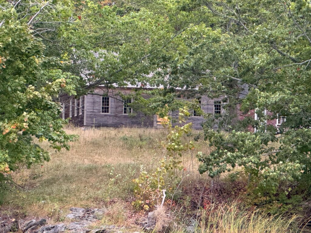
On the way up the river, we couldn’t see much, but on the way back down, with the tide going out, piers were just visible. They looked very much like those which supported Norwood’s Wharf. This would have been Norwood land, so perhaps the family utilized the same design whenever building a dock?
As we went further upstream, Chris pointed out underwater jetties and the way in which they re-routed water, altering the opposite shoreline. The map Arthur pulled from the drink showed what the shore had looked like before one of these jetties. Now it is a smooth crescent.
Once we’d reached the falls, we studied the dam, looked for traces of the shipyard, and examined a massive earthwork being undertaken just below the mills to shore up the bank.
With a light rain settling in and a cold wind picking up, we headed back down the river. Cold, bundled up in hoods and tightly pulled jackets, but content that we’d accomplished what we hoped to. The river has certainly changed, but there are hints of what it was once like. You just need to look.
— Prof. Eric G. E. Zuelow