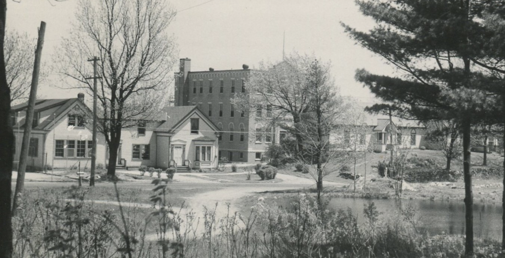
There are two buildings at the heart of our class research: The Willows and the Wayside.
This said, it is worth getting a larger sense of the area as it existed in the past so that we know what was where and when. Old maps offer a tantalizing sense of how things once looked, including owners’ names and a sense of the spatial relationship between buildings/families.
The earliest map that we’ve seen thus far dates to 1856.
Looking carefully, we find the C&E Jordon House clearly listed. Parts of that building still exist within what is now Stella Maris Hall (the cellar and bay windows), the current offices of the College of Osteopathic Medicine. We may find it worth exploring this building later in the course. For now, we believe that it was built in the 1750s on the site of a 1720s garrison house. It occupies the high ground on campus and would probably have featured impressive views during the period that it was a garrison, especially if tree cover was less prevalent than it is today.
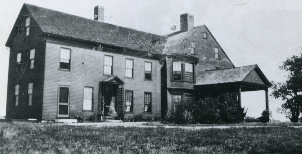
Another building appears just to the north of the Jordan House. Resolution is not great, but it looks to be associated with somebody named C. [Charles] Huff. As it stands, we know nothing about this individual beyond his name, but the house appears to be what we know as The Willows. Was Huff the original owner? Did he build the structure or can we trace things back further?
By 1872, the Willows changed hands and was owned by Lorenzo D. Mitchell. Oddly, the Huff building is now missing.


This map hints at additional stories that are worth exploring, both in the archives and potentially in the ground. The J. Coolbrath House is now limited to faintly visible foundations. We know virtually nothing about it beyond the fact that it would be a wonderful site for future historical/archaeological work.
Much the same is true of the S. Adams House which now consists of a foundation resting next to our campus tennis courts. The foundations suggest at least two periods of construction, one nineteenth century (or before), the other twentieth century. We’d love to explore that site during some future iteration of this course. The C. Tongue House is currently a private home and sits just off campus next to the family graveyard of the Jordan/Tatterson families.
A more recent map points us to the story we’ll be exploring in depth. This document was completed as one of the various house/property sales for which records exist in the Featherman University Archives at UNE.
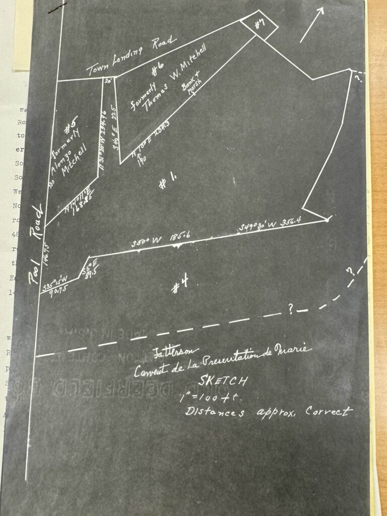
It is interesting to note that the road appears to be oriented very differently than it is today. Indeed, there is no longer a “Town Landing Road” at all (or a town landing, for that matter… although some remains of it are visible). This invites exploration of the changing placement of transportation routes in the area.
The second thing that is clear from this map are the names Lorenzo and Alonzo Mitchell, father and son. Just who were these men? What are there stories? We’ll need to dig into quite different types of sources if we are to find out.
—Prof. Eric G. E. Zuelow