
Time Team New England is back for a second season! As in 2024, professors Arthur Anderson and Eric Zuelow, along with their students, have just one semester to come to an understanding of a site on the University of New England campus. They will use the tools of both archaeology and history in their pursuit of the people who lived and worked here, who altered the land to suit, and who made this place what it is today.
Over the next 15-weeks, this blog will provide a running narrative of our progress. It will tell the story of our dig days, highlight new information, and share photographs and other information as we find it.
Back in 2024, Time Team New England focused on a small set of questions. Fundamentally, we wondered about a house that once stood in front of what is now Decary Hall. Almost immediately, we discovered that we were actually looking at two houses, but one family. One family in two parts, that is. They did not get on at all. If you want to learn more, check out the student podcasts and the blog posts below.
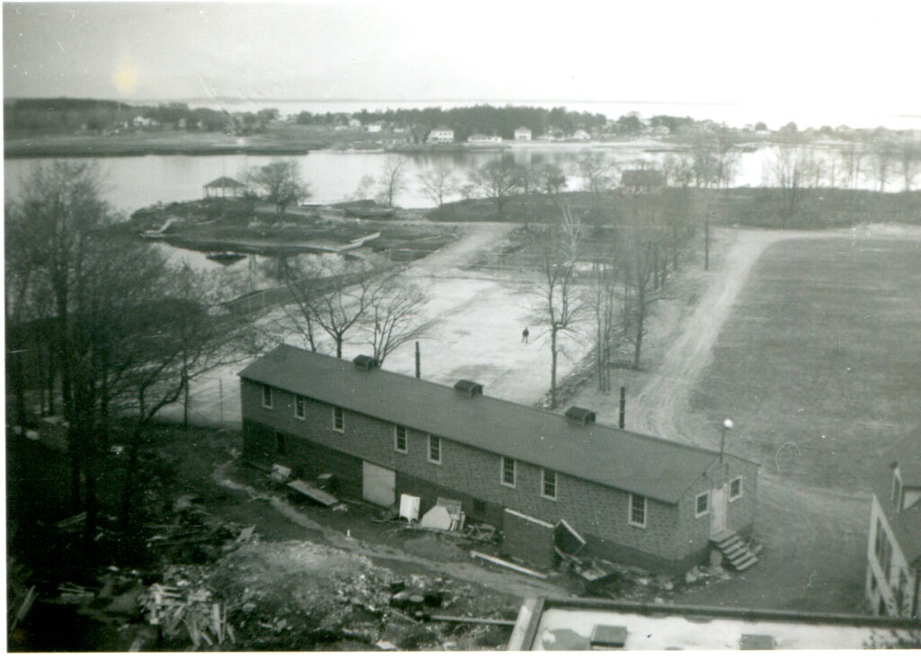
This year, our project appears to be much bigger. We want to come to grips with UNE’s waterfront, the strip of campus extending from Jordan’s Point in the west to the Marine Sciences Building in the east.
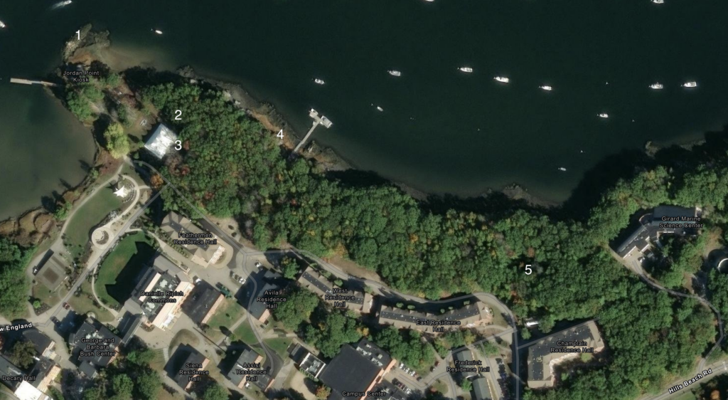
We’re asking a lot of questions, nervously hoping that we can find answers.
Jordan’s Point
Jordan’s Point represents a familiar site to most St. Francis College and UNE students. From very early in the story of St. Francis College, there was a kiosk there which provided a sheltered spot to sit and read, to watch birds soaring and fish jumping. The kiosk itself changed over time, with at least four separate designs over the years, but it remained a constant.
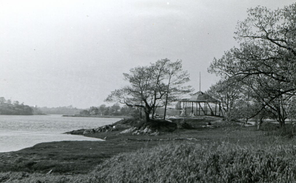
The story of Jordan’s Point is a longer one, though. It is named after one of the earliest families in the area, owners of the house that is now Stella Maris Hall. Their family graveyard rests at the corner of Hills Beach Road and Old Pool Road. The house itself dates to the eighteenth century. It stands on the site of a garrison house that dates to much earlier.
Long before the Jordan family arrived, the Wabanaki occupied this place. They had a seasonal village in the area, raised crops, and sailed far out to sea in dugout canoes to hunt swordfish. When Samuel de Champlain arrived, one of the first Europeans to make contact with Maine’s native inhabitants, it is easy to imagine that the site offered a vantage point from which to watch the French explorer’s ship arrive, a harbinger of dramatic, often unthinkably tragic, change.
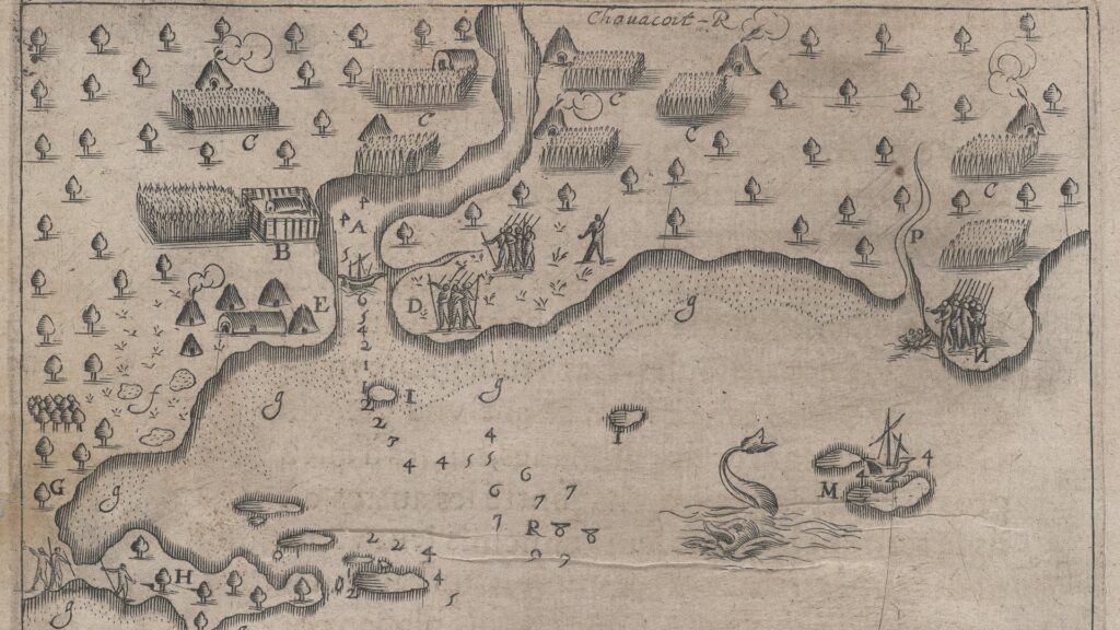
Once Europeans had fully settled the area and established lives based on both farming and fishing, they set about altering the area. At Jordan’s Point, early twentieth century images reflect one of their alterations: a seawall or jetty. The mouth of the Saco River naturally features a sandbar, navigable only at high tide. This was a problem for the many vessels laden with textiles, timber, and other goods, not to mention for the tall ships being built in several shipyards located just below the falls. The Army Corps of Engineers constructed a jetty at Camp Ellis to alleviate the problem. Did they also build a smaller one at Jordan’s Point? If so, why did they ultimately let it collapse?
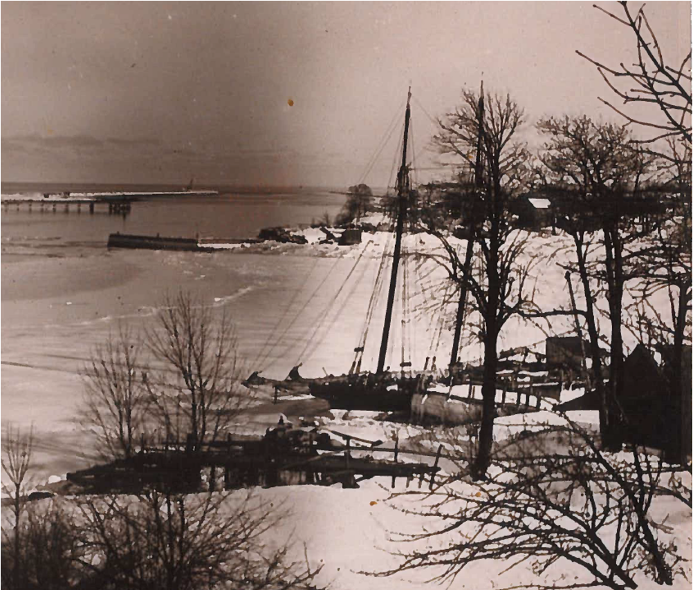
Famously, the jetty at Camp Ellis did result in the removal of the sandbar in the river. Indeed, it shifted the deposit of sand significantly, moving it up the coast to Pine Point where it now threatens the mouth of the Nonesuch River. At the same time, that jetty yields dramatic erosion at Camp Ellis such that each decade another city block falls into the Gulf of Maine. (A new jetty is currently being built to remedy that problem, although many experts are skeptical about the likely results.)
What of the little jetty at Jordan’s Point? What impact did it have? Was it allowed to collapse because it either had no impact or too much? We’d like to find out.
The Cottage
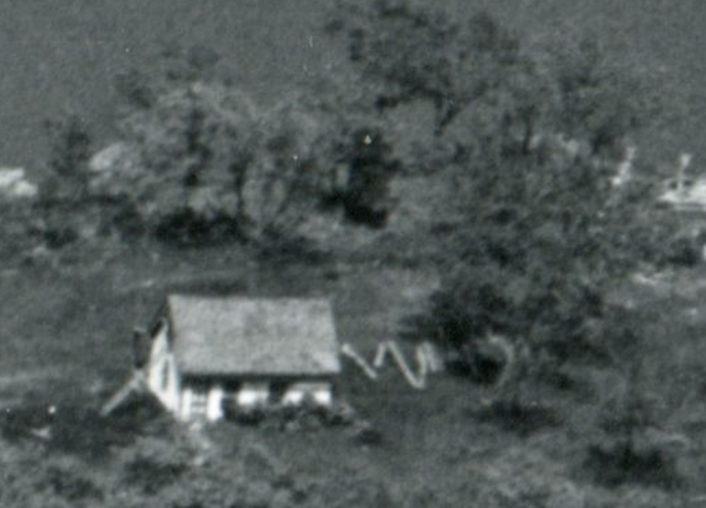
Moving just a few feet east of the point, photographs dating from the very start of the twentieth century and running up to at least the early 1960s show a small cottage near Jordan’s Point. It is a modest place, although the earliest known photograph (the same image that shows the jetty) hints at something perhaps larger than what appears in later years.
Who lived there? What is that person’s (or people’s) story?
An 1872 map that includes the names of property owners across the area attributes the name “J. Coolbrath” to the site. Local historian Karen Casey expands on this. The 1870 census, she says, shows a Joseph Coolbroth (Coolbrath?), a 52 year old carpenter, living in the area. Two years on, Coolbrath is listed as a fireman.
The Biddeford Fire Department started life in the 1840s, but, according to Biddeford Fire Department Museum Curator Mike Tremblay, it was a voluntary organization save for a single individual who maintained the horse and steamer. That one individual was not J. Coolbrath. It follows that by 1872 he probably worked at the Biddeford Mills, an environment notoriously prone to fire. Indeed, on May 28, 1872 the Shaw’s Block was destroyed by a massive conflagration. Was Coolbrath there? Can we learn more about him and his life in this area?
The Tower
A 1955 aerial photograph, the same one that gave birth to the original Time Team course idea, shows the little cottage, but a closer inspection shows something else—a mysterious tower-like structure adjacent to the house. It doesn’t seem to appear in any other known photographs. What on earth is it? Can we find out?
The Ghostly Gazebo
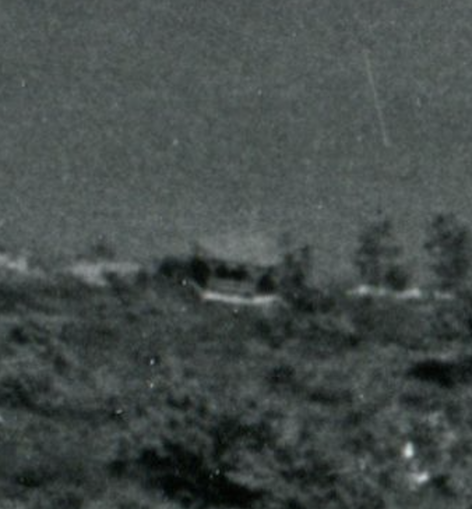
If we move a little further east, that same photograph shows another mystery structure. It looks something like a gazebo. But is that what it is? Why is it there? Did St. Francis College build it or is it somehow related to one of the no longer extant houses? What can we learn?
The Bigger House
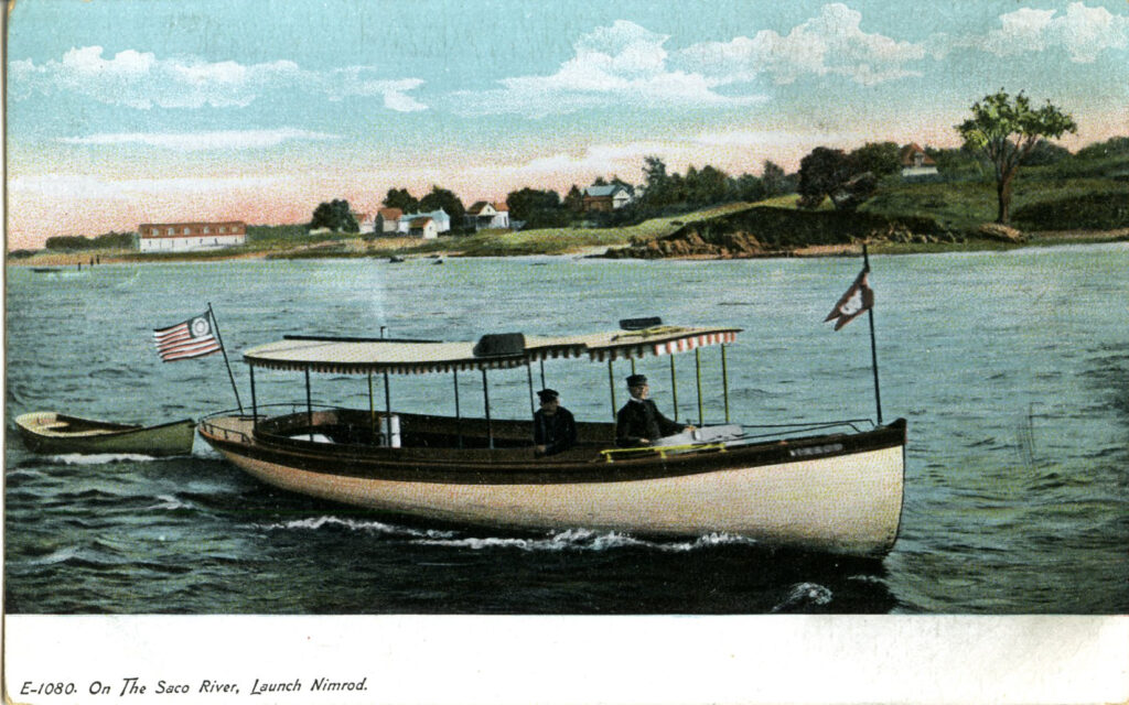
Moving still further to the east, postcards depicting the view from Camp Ellis show another, larger, house. It is shown with a red roof and has a large second floor. The building does not seem to appear on the 1872 map, so evidently it was built after that.
Two 1962 photographs, one with text saying that the “cottage” was purchased by St. Francis College, may provide much closer views of the building, offering greater detail. Is it the same building visible in the postcards?
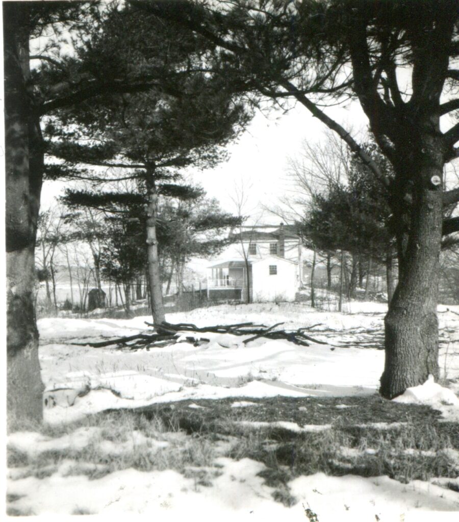
Where exactly was the building? If we line up rock features along the river with the building and with the current Marine Sciences Building, it looks like the house was a little to the west. Certainly we have no information suggesting that foundations were discovered when the current building was erected, so perhaps it stood near what is now Champlain Residence Hall?
Deeper Histories
Finally, as noted above, this area was home to the Wabanaki for thousands of years. Test pits along the whole of our waterfront, not to mention the more extensive studies conducted by Time Team New England’s own Arthur Anderson, have turned up significant archaeological evidence. We may encounter some of that too, perhaps adding to our understanding of the deeper history of this place.
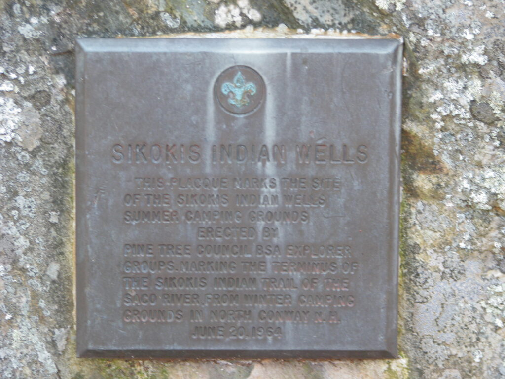
Closely related to that, in June 1964 a group of Boy Scouts from the Pine Tree Council visited the St. Francis College Campus, marking the terminus of a much longer “Sikokis Indian Trail” that extended from North Conway, NH to the mouth of the Saco River. They apparently camped and installed a plaque marking the “Sikokis Indian Wells.”
Separately, when working with Pete Thomas during the first iteration of Time Team New England, we heard oral history recounting the existence of a spring that sailors long used, right back to De Champlain, to take on fresh water before heading out to sea. There is no longer any sign of a spring or well. Perhaps it ran dry when the hydrology of the area was altered by expansion of the campus and surrounding houses. So where was it? Can we locate the site? If we can, there is probably a great deal to learn.
All of which is to say, we should all buckle up. There’s a lot to learn and if we add up available class time, there isn’t much more than three days to learn it in. We’re in for a wild ride!
— Prof. Eric G. E. Zuelow